View a map of the zero emission zone (ZEZ)
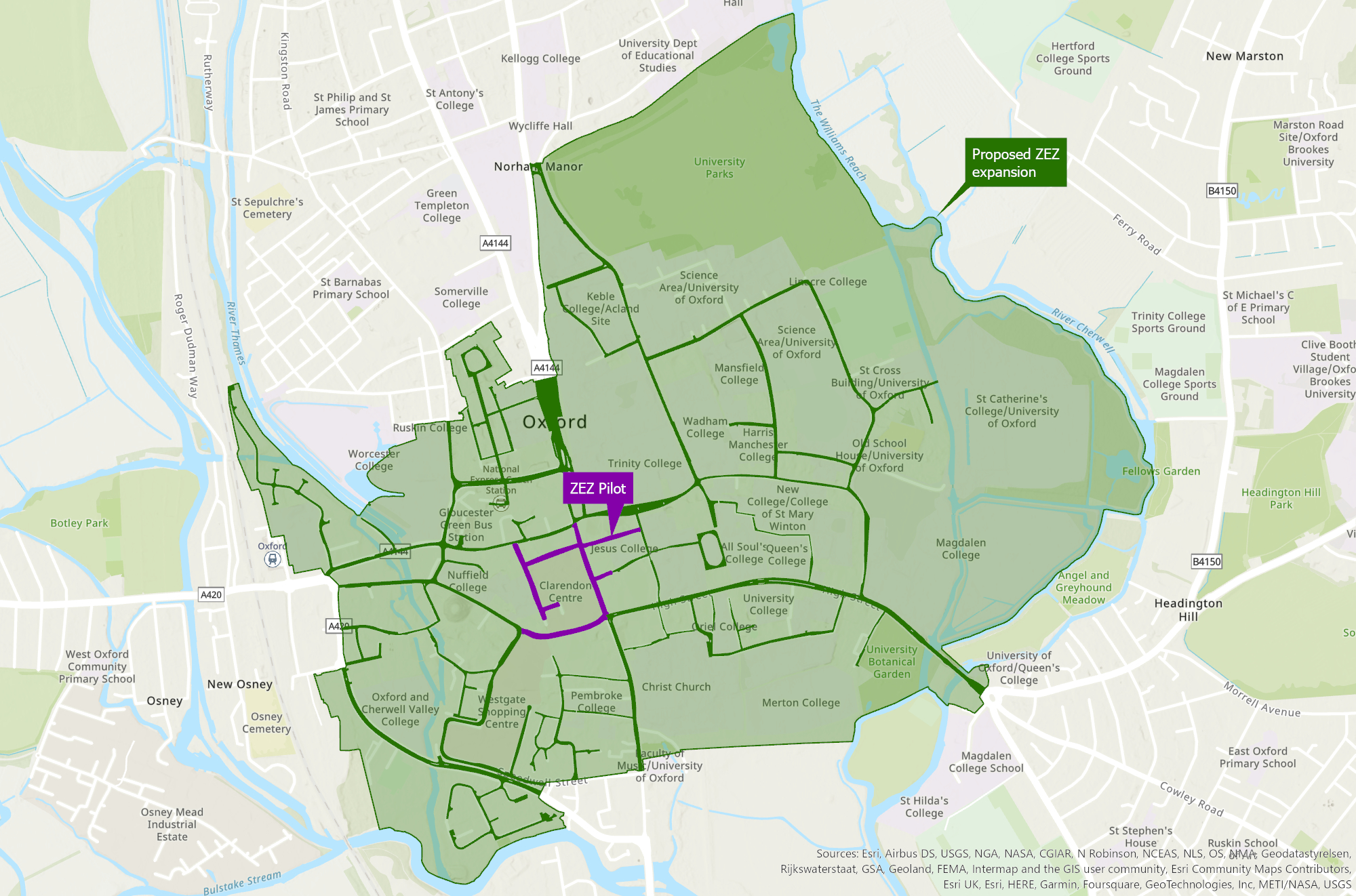
Map of area and streets included in Oxford's zero emission zone.
The zero emission zone covers the following streets in Oxford city centre.
| Street | Length |
|---|---|
| New Road | Between Bonn Square and its junction with Castle Street |
| Bonn Square | Whole length |
| Queen Street | Whole length |
| Cornmarket Street | Whole length |
| New Inn Hall Street | Whole length |
| Shoe Lane | Whole length |
| Market Street | From its junction with Cornmarket, extending east for 40 metres |
| Ship Street | Whole length |
| St Michael’s Street | Whole length |
Map
View a map showing the pilot roads (pdf format, 1.2Mb) or a map showing the proposed second phase zones (jpg format, 700KB).
Other travel options
To improve Oxford’s air quality and avoid paying ZEZ charges you can choose to walk, cycle, e-scoot or use public transport (including park and ride).
We encourage sustainable travel through our Local Transport Plan.